
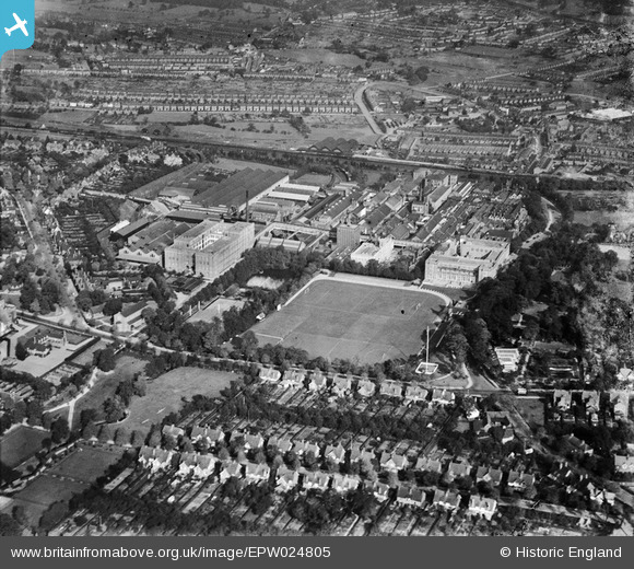
EPW024805 ENGLAND (1928). The Bournville Cocoa and Chocolate Works and environs, Bournville, 1928
© Copyright OpenStreetMap contributors and licensed by the OpenStreetMap Foundation. 2026. Cartography is licensed as CC BY-SA.
Nearby Images (25)
EPW024805

EPW001237

EPW024796

EPW024810

EPW024801

EPW024798

EPW024809

EPW024799

EPW024804

EPW024800

EPW024797

EPW024812

EPW005071

EPW024803

EPW024811

EPW024802

EPW001104

EPW024808

EPW024806

EPW024807

EPW001232

EPW005072

EPW001238

EPW022580

EPW001230

Details
| Title | [EPW024805] The Bournville Cocoa and Chocolate Works and environs, Bournville, 1928 |
| Reference | EPW024805 |
| Date | September-1928 |
| Link | |
| Place name | BOURNVILLE |
| Parish | |
| District | |
| Country | ENGLAND |
| Easting / Northing | 404687, 281162 |
| Longitude / Latitude | -1.9310606490547, 52.428045530572 |
| National Grid Reference | SP047812 |
Pins
Be the first to add a comment to this image!