
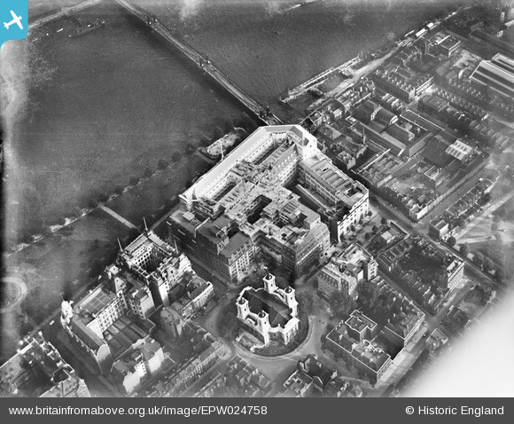
EPW024758 ENGLAND (1928). St John's Church and Smith Square, Westminster, 1928
© Copyright OpenStreetMap contributors and licensed by the OpenStreetMap Foundation. 2026. Cartography is licensed as CC BY-SA.
Nearby Images (24)
EPW024758

EPW025096

EPW025094

EPW042212

EPW017276

EPW022790

EPW025095

EPW022797

EAW001430

EPW022791

EPW020953

EPW060791

EPW037971

EPW046256

EPW022793

EPW022794

EPW022798

EAW000529

EAW000476

EAW000526

EPW059351

EPW005595

EAW043636A

EAW043639

Details
| Title | [EPW024758] St John's Church and Smith Square, Westminster, 1928 |
| Reference | EPW024758 |
| Date | September-1928 |
| Link | |
| Place name | WESTMINSTER |
| Parish | |
| District | |
| Country | ENGLAND |
| Easting / Northing | 530188, 179065 |
| Longitude / Latitude | -0.12438531806977, 51.495033269232 |
| National Grid Reference | TQ302791 |
Pins

Alan McFaden |
Wednesday 10th of September 2014 10:40:17 AM | |
|
Alan McFaden |
Wednesday 10th of September 2014 10:39:31 AM | |
|
Alan McFaden |
Wednesday 10th of September 2014 10:38:34 AM | |
|
Alan McFaden |
Wednesday 10th of September 2014 10:37:50 AM | |

Jeannette |
Friday 14th of June 2013 08:54:34 PM |


