
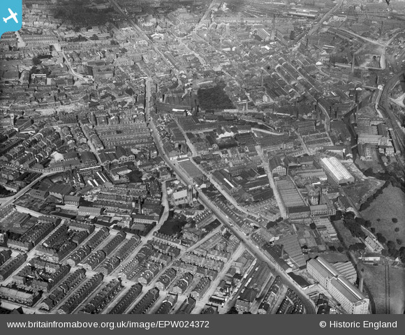
EPW024372 ENGLAND (1928). South Street and environs, Keighley, from the south-west, 1928
© Copyright OpenStreetMap contributors and licensed by the OpenStreetMap Foundation. 2026. Cartography is licensed as CC BY-SA.
Nearby Images (2)
EPW024372

EPW024376

Details
| Title | [EPW024372] South Street and environs, Keighley, from the south-west, 1928 |
| Reference | EPW024372 |
| Date | September-1928 |
| Link | |
| Place name | KEIGHLEY |
| Parish | KEIGHLEY |
| District | |
| Country | ENGLAND |
| Easting / Northing | 405911, 440563 |
| Longitude / Latitude | -1.9101142948469, 53.861046927819 |
| National Grid Reference | SE059406 |
Pins

J May |
Wednesday 11th of July 2018 06:34:54 PM | |
|
Historylover |
Monday 6th of January 2014 10:19:16 AM | |
|
Historylover |
Monday 6th of January 2014 10:15:37 AM | |
|
Historylover |
Monday 6th of January 2014 10:10:57 AM | |
|
Historylover |
Monday 6th of January 2014 10:09:48 AM | |
|
Historylover |
Monday 6th of January 2014 10:09:07 AM | |
|
Historylover |
Monday 6th of January 2014 10:08:07 AM | |
|
Historylover |
Monday 6th of January 2014 10:07:16 AM |
