
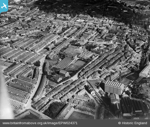
EPW024371 ENGLAND (1928). The Devonshire Worsted Mills and environs, Keighley, 1928
© Copyright OpenStreetMap contributors and licensed by the OpenStreetMap Foundation. 2026. Cartography is licensed as CC BY-SA.
Nearby Images (2)
EPW024371

EPW024377

Details
| Title | [EPW024371] The Devonshire Worsted Mills and environs, Keighley, 1928 |
| Reference | EPW024371 |
| Date | September-1928 |
| Link | |
| Place name | KEIGHLEY |
| Parish | KEIGHLEY |
| District | |
| Country | ENGLAND |
| Easting / Northing | 405653, 441166 |
| Longitude / Latitude | -1.914026458464, 53.866470111108 |
| National Grid Reference | SE057412 |
Pins

Class31 |
Tuesday 14th of October 2014 08:17:05 PM |
