
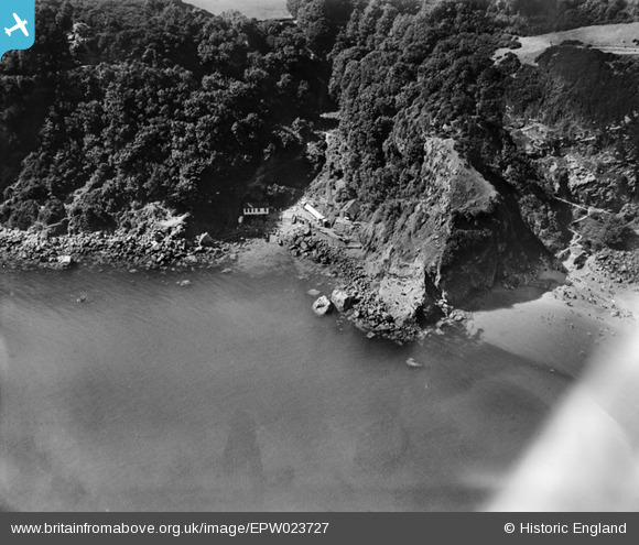
EPW023727 ENGLAND (1928). Anstey's Cove and Devil's Point, Torquay, 1928
© Copyright OpenStreetMap contributors and licensed by the OpenStreetMap Foundation. 2026. Cartography is licensed as CC BY-SA.
Nearby Images (2)
EPW023727

EPW033405

Details
| Title | [EPW023727] Anstey's Cove and Devil's Point, Torquay, 1928 |
| Reference | EPW023727 |
| Date | September-1928 |
| Link | |
| Place name | TORQUAY |
| Parish | |
| District | |
| Country | ENGLAND |
| Easting / Northing | 293575, 64672 |
| Longitude / Latitude | -3.4998888343932, 50.471597752989 |
| National Grid Reference | SX936647 |
Pins
Be the first to add a comment to this image!