
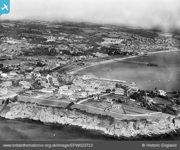
EPW023713 ENGLAND (1928). Roundham Head and Paignton Sands, Paignton, from the south, 1928
© Copyright OpenStreetMap contributors and licensed by the OpenStreetMap Foundation. 2025. Cartography is licensed as CC BY-SA.
Nearby Images (2)
EPW023713

EAW007579

Details
| Title | [EPW023713] Roundham Head and Paignton Sands, Paignton, from the south, 1928 |
| Reference | EPW023713 |
| Date | September-1928 |
| Link | |
| Place name | PAIGNTON |
| Parish | |
| District | |
| Country | ENGLAND |
| Easting / Northing | 289566, 60020 |
| Longitude / Latitude | -3.5549956687884, 50.429030852385 |
| National Grid Reference | SX896600 |
Pins

Treecutter75 |
Saturday 9th of March 2013 04:26:42 PM | |
|
Treecutter75 |
Saturday 9th of March 2013 03:45:35 PM | |
|
Treecutter75 |
Saturday 9th of March 2013 03:34:05 PM | |
|
Treecutter75 |
Saturday 9th of March 2013 03:32:11 PM | |
|
Treecutter75 |
Saturday 9th of March 2013 03:31:05 PM | |
|
Treecutter75 |
Saturday 9th of March 2013 03:29:57 PM | |
|
Treecutter75 |
Saturday 9th of March 2013 03:29:16 PM | |
|
Treecutter75 |
Saturday 9th of March 2013 03:26:32 PM |