
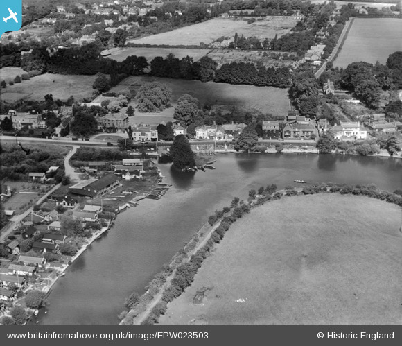
EPW023503 ENGLAND (1928). The River Thames and Chertsey Road, Shepperton, 1928
© Copyright OpenStreetMap contributors and licensed by the OpenStreetMap Foundation. 2025. Cartography is licensed as CC BY-SA.
Nearby Images (5)
EPW023503

EPW023497

EPW020201

EPW020201
EPW043786

Details
| Title | [EPW023503] The River Thames and Chertsey Road, Shepperton, 1928 |
| Reference | EPW023503 |
| Date | September-1928 |
| Link | |
| Place name | SHEPPERTON |
| Parish | |
| District | |
| Country | ENGLAND |
| Easting / Northing | 508395, 166788 |
| Longitude / Latitude | -0.44197931571809, 51.389271973395 |
| National Grid Reference | TQ084668 |
Pins

bumblee |
Tuesday 4th of August 2015 01:11:04 PM | |
|
David960 |
Sunday 25th of January 2015 06:20:48 PM | |
|
David960 |
Sunday 25th of January 2015 06:17:46 PM | |
|
David960 |
Sunday 25th of January 2015 06:17:26 PM | |
|
bumblee |
Friday 11th of October 2013 03:16:01 PM | |
|
bumblee |
Friday 11th of October 2013 03:14:56 PM | |
|
bumblee |
Friday 11th of October 2013 03:13:26 PM | |
|
bumblee |
Friday 11th of October 2013 03:12:09 PM | |
|
bumblee |
Friday 11th of October 2013 03:10:18 PM | |
|
Dave Wedd |
Thursday 4th of July 2013 04:38:04 PM |
User Comment Contributions
This image is actually Russell Road (left to right) looking up along Manygate Lane (top right). Shepperton |
JJJ75 |
Thursday 28th of June 2012 12:28:00 AM |