
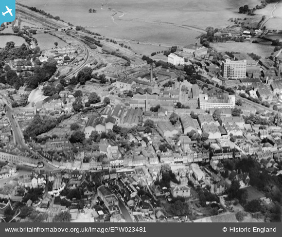
EPW023481 ENGLAND (1928). The Staines Linoleum Company Works, Staines, 1928
© Copyright OpenStreetMap contributors and licensed by the OpenStreetMap Foundation. 2026. Cartography is licensed as CC BY-SA.
Nearby Images (23)
EPW023481

EPW061665

EPW009569

EPW023480

EPW009567

EPW023477

EPW009570

EPW023473

EPW023488

EPW023491

EPW023472

EPW023486

EPW023471

EPW023475

EPW023478

EPW023474

EPW023490

EPW023485

EPW061668

EPW061672

EPW009568

EPW023492

EPW049560

Details
| Title | [EPW023481] The Staines Linoleum Company Works, Staines, 1928 |
| Reference | EPW023481 |
| Date | September-1928 |
| Link | |
| Place name | STAINES |
| Parish | |
| District | |
| Country | ENGLAND |
| Easting / Northing | 503481, 171762 |
| Longitude / Latitude | -0.51113274782163, 51.434903859663 |
| National Grid Reference | TQ035718 |
Pins

Billy121 |
Thursday 17th of July 2014 10:57:57 AM | |
|
Isleworth1961 |
Monday 3rd of December 2012 01:25:14 PM |