
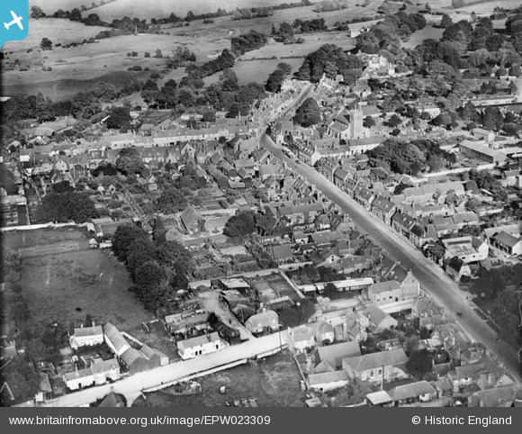
EPW023309 ENGLAND (1928). The High Street and town centre, New Alresford, 1928
© Copyright OpenStreetMap contributors and licensed by the OpenStreetMap Foundation. 2026. Cartography is licensed as CC BY-SA.
Nearby Images (8)
EPW023309

EPW032307

EPW023313

EPW032308

EPW023310

EPW023311

EPW032306

EPW023315

Details
| Title | [EPW023309] The High Street and town centre, New Alresford, 1928 |
| Reference | EPW023309 |
| Date | September-1928 |
| Link | |
| Place name | NEW ALRESFORD |
| Parish | NEW ALRESFORD |
| District | |
| Country | ENGLAND |
| Easting / Northing | 458702, 132691 |
| Longitude / Latitude | -1.1617177043351, 51.089993164327 |
| National Grid Reference | SU587327 |
Pins

David960 |
Saturday 24th of January 2015 01:58:18 PM | |
|
David960 |
Saturday 24th of January 2015 01:50:28 PM | |
|
David960 |
Saturday 24th of January 2015 01:49:09 PM | |
|
David960 |
Saturday 24th of January 2015 01:48:16 PM | |
|
David960 |
Saturday 24th of January 2015 01:47:54 PM | |
|
David960 |
Saturday 24th of January 2015 01:47:05 PM | |
|
David960 |
Saturday 24th of January 2015 01:46:13 PM | |
|
David960 |
Saturday 24th of January 2015 01:45:23 PM | |
|
David960 |
Saturday 24th of January 2015 01:42:35 PM |