
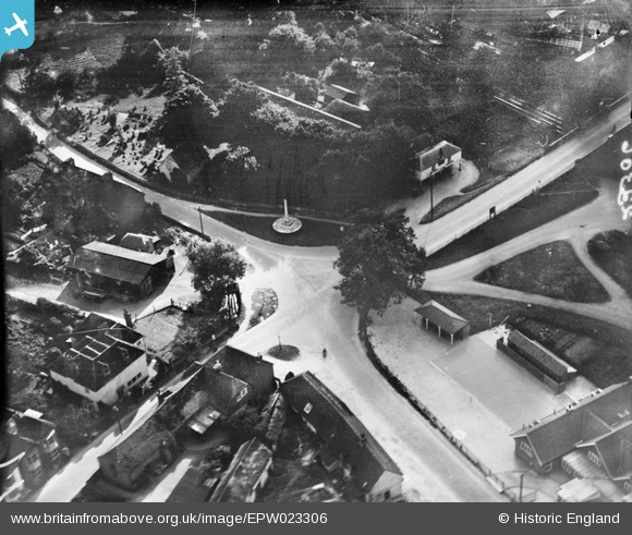
EPW023306 ENGLAND (1928). The war memorial and environs, Stockbridge, 1928
© Copyright OpenStreetMap contributors and licensed by the OpenStreetMap Foundation. 2026. Cartography is licensed as CC BY-SA.
Nearby Images (3)
EPW023306

EPW033731

EPW033725

Details
| Title | [EPW023306] The war memorial and environs, Stockbridge, 1928 |
| Reference | EPW023306 |
| Date | September-1928 |
| Link | |
| Place name | STOCKBRIDGE |
| Parish | STOCKBRIDGE |
| District | |
| Country | ENGLAND |
| Easting / Northing | 435963, 135044 |
| Longitude / Latitude | -1.4861845844738, 51.113030335401 |
| National Grid Reference | SU360350 |
Pins
User Comment Contributions
View looking south west. |

Class31 |
Wednesday 30th of October 2013 10:27:43 AM |