
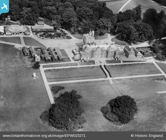
EPW023271 ENGLAND (1928). Clayesmore School, Pangbourne, 1928
© Copyright OpenStreetMap contributors and licensed by the OpenStreetMap Foundation. 2026. Cartography is licensed as CC BY-SA.
Nearby Images (8)
EPW023271

EPW023266

EPW023268

EPW023270

EPW023267

EPW023264

EAW017629

EPW023269

Details
| Title | [EPW023271] Clayesmore School, Pangbourne, 1928 |
| Reference | EPW023271 |
| Date | September-1928 |
| Link | |
| Place name | PANGBOURNE |
| Parish | PANGBOURNE |
| District | |
| Country | ENGLAND |
| Easting / Northing | 461874, 175501 |
| Longitude / Latitude | -1.109009104849, 51.474597006935 |
| National Grid Reference | SU619755 |
Pins
Be the first to add a comment to this image!
User Comment Contributions
Now Pangbourne College. Clayesmore School " moved to Iwerne Minster for the summer term of 1933" according to Wikipedia |

Jakecat |
Monday 7th of January 2013 01:09:46 PM |