
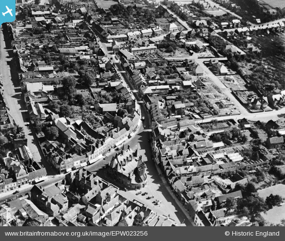
EPW023256 ENGLAND (1928). The Town Hall and Market Place, Wokingham, 1928
© Copyright OpenStreetMap contributors and licensed by the OpenStreetMap Foundation. 2026. Cartography is licensed as CC BY-SA.
Nearby Images (4)
EPW023256

EPW023262

EPW023255

EPW023254

Details
| Title | [EPW023256] The Town Hall and Market Place, Wokingham, 1928 |
| Reference | EPW023256 |
| Date | September-1928 |
| Link | |
| Place name | WOKINGHAM |
| Parish | WOKINGHAM |
| District | |
| Country | ENGLAND |
| Easting / Northing | 481285, 168567 |
| Longitude / Latitude | -0.83113692556174, 51.409798869676 |
| National Grid Reference | SU813686 |
Pins

Imogen |
Tuesday 30th of December 2025 10:53:07 AM | |
|
fatbirdwatcher |
Tuesday 28th of February 2017 05:49:19 AM | |
|
fatbirdwatcher |
Tuesday 28th of February 2017 05:48:40 AM | |
|
fatbirdwatcher |
Tuesday 28th of February 2017 05:47:05 AM | |
|
David960 |
Thursday 5th of February 2015 11:19:39 PM | |
|
David960 |
Thursday 5th of February 2015 11:17:59 PM | |
|
David960 |
Thursday 5th of February 2015 11:16:44 PM |