
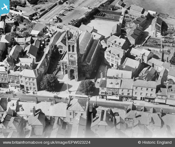
EPW023224 ENGLAND (1928). St Paul's Church, Honiton, 1928
© Copyright OpenStreetMap contributors and licensed by the OpenStreetMap Foundation. 2026. Cartography is licensed as CC BY-SA.
Nearby Images (7)
EPW023224

EPW013500

EPW023225

EAW051931

EPW013499

EAW051933

EAW051932

Details
| Title | [EPW023224] St Paul's Church, Honiton, 1928 |
| Reference | EPW023224 |
| Date | September-1928 |
| Link | |
| Place name | HONITON |
| Parish | HONITON |
| District | |
| Country | ENGLAND |
| Easting / Northing | 316340, 100732 |
| Longitude / Latitude | -3.1872768796943, 50.799538191124 |
| National Grid Reference | ST163007 |
Pins

MB |
Friday 23rd of November 2012 12:34:44 PM | |
|
MB |
Friday 23rd of November 2012 12:30:19 PM | |
|
MB |
Friday 23rd of November 2012 12:29:04 PM | |
|
MB |
Friday 23rd of November 2012 12:28:22 PM | |
|
MB |
Friday 23rd of November 2012 12:27:20 PM | |
|
Whittocks |
Sunday 15th of July 2012 09:54:05 PM |
User Comment Contributions
Plenty of folks standing and staring outside the Angel Hotel in Honiton. |
Whittocks |
Sunday 15th of July 2012 09:55:22 PM |