
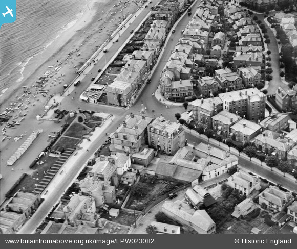
EPW023082 ENGLAND (1928). The junction of Victoria Road, High Street and Avenue Slipway, Sandown, 1928
© Copyright OpenStreetMap contributors and licensed by the OpenStreetMap Foundation. 2026. Cartography is licensed as CC BY-SA.
Nearby Images (6)
EPW023082

EAW038581

EPW043025

EAW022218

EPW043026

EPW016862

Details
| Title | [EPW023082] The junction of Victoria Road, High Street and Avenue Slipway, Sandown, 1928 |
| Reference | EPW023082 |
| Date | August-1928 |
| Link | |
| Place name | SANDOWN |
| Parish | SANDOWN |
| District | |
| Country | ENGLAND |
| Easting / Northing | 460175, 84410 |
| Longitude / Latitude | -1.1486323787913, 50.655675018544 |
| National Grid Reference | SZ602844 |

