
EPW022927 ENGLAND (1928). The town centre, Midhurst, 1928

© Copyright OpenStreetMap contributors and licensed by the OpenStreetMap Foundation. 2026. Cartography is licensed as CC BY-SA.
Nearby Images (2)
EPW022927

EPW022947

Details
| Title | [EPW022927] The town centre, Midhurst, 1928 |
| Reference | EPW022927 |
| Date | August-1928 |
| Link | |
| Place name | MIDHURST |
| Parish | MIDHURST |
| District | |
| Country | ENGLAND |
| Easting / Northing | 488678, 121464 |
| Longitude / Latitude | -0.73649295385506, 50.985198686761 |
| National Grid Reference | SU887215 |
Pins

Class31 |
Sunday 29th of May 2016 06:46:16 AM | |
|
Class31 |
Sunday 29th of May 2016 06:38:04 AM | |
|
Class31 |
Saturday 28th of May 2016 06:39:30 PM | |

David960 |
Monday 26th of January 2015 07:54:45 PM | |
|
David960 |
Monday 26th of January 2015 07:53:25 PM | |
|
David960 |
Saturday 24th of January 2015 06:19:54 PM | |
|
David960 |
Saturday 24th of January 2015 06:18:17 PM | |
|
David960 |
Saturday 24th of January 2015 06:14:34 PM | |
|
David960 |
Saturday 24th of January 2015 06:14:10 PM | |
|
David960 |
Saturday 24th of January 2015 06:12:25 PM | |
|
David960 |
Saturday 24th of January 2015 06:11:59 PM | |
|
David960 |
Saturday 24th of January 2015 06:11:33 PM |


User Comment Contributions

War Memorial, Midhurst, 25/05/2016 |
Class31 |
Sunday 29th of May 2016 06:49:44 AM |
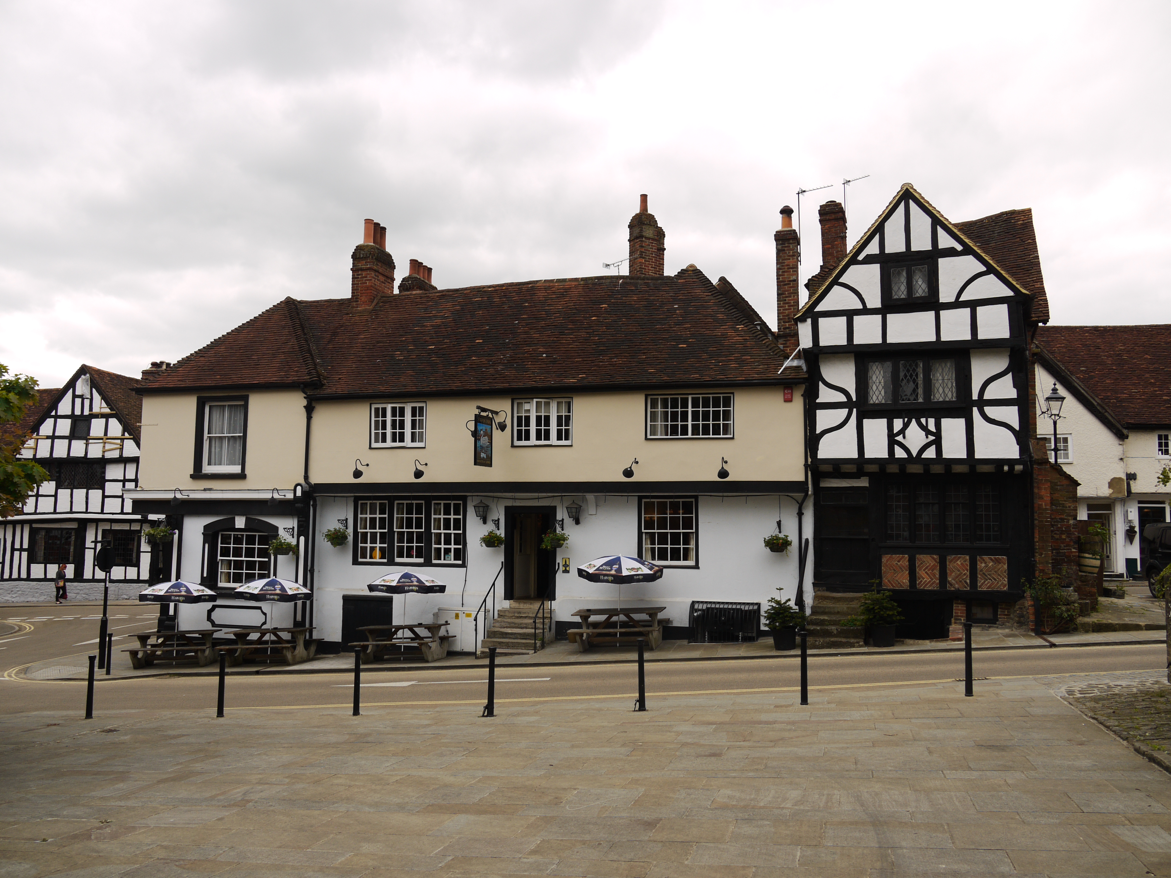
The Swan Inn PH, Midhurst, 25/05/2016 |
Class31 |
Sunday 29th of May 2016 06:47:44 AM |
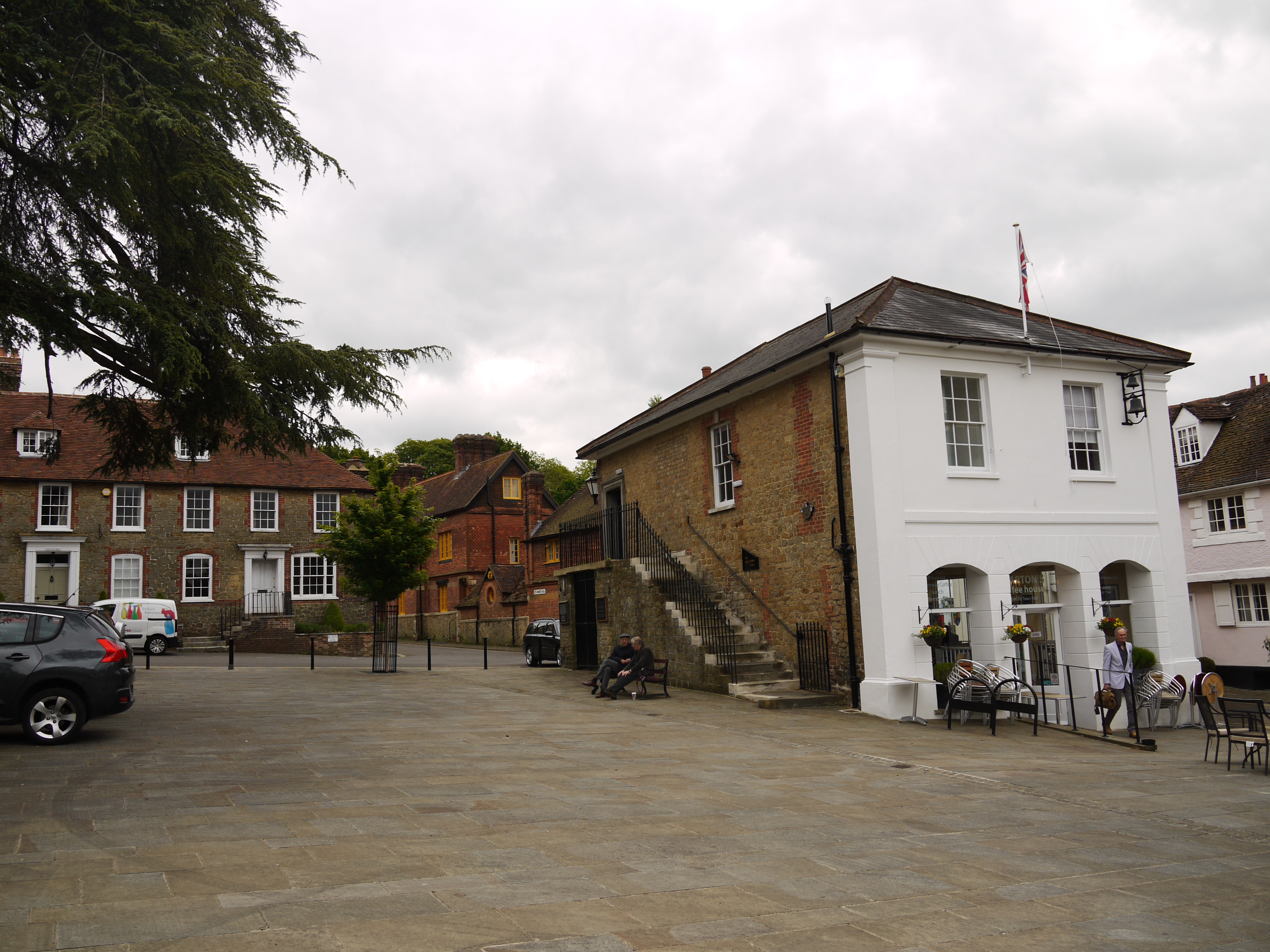
The Old Town Hall, Midhurst, 25/05/2016 |
Class31 |
Sunday 29th of May 2016 06:47:07 AM |

St. Mary Magdalene & St Denys Church, Midhurst, 25/05/2016 |
Class31 |
Sunday 29th of May 2016 06:41:33 AM |

The Spread Eagle Hotel, Midhurst, 25/05/2016 |
Class31 |
Sunday 29th of May 2016 06:39:46 AM |

The Wheatsheaf PH, Midhurst, 25/05/2016 |
Class31 |
Sunday 29th of May 2016 06:37:10 AM |

A number of past and present Midhurst pubs visible here. |
David960 |
Monday 26th of January 2015 07:54:23 PM |