
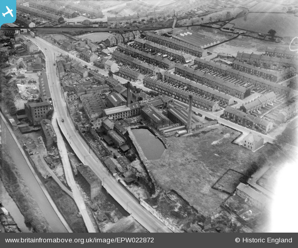
EPW022872 ENGLAND (1928). The Crosland Moor Woollen Mills and environs, Crosland Moor, 1928
© Copyright OpenStreetMap contributors and licensed by the OpenStreetMap Foundation. 2026. Cartography is licensed as CC BY-SA.
Nearby Images (18)
EPW022872

EPW022873

EPW022866

EPW022867

EPW022864

EPW022865

EPW022874

EPW022863

EPW054248

EPW054266

EAW020077

EAW020070

EAW020071

EAW020075

EAW020074

EAW020073

EAW020072

EAW020076

Details
| Title | [EPW022872] The Crosland Moor Woollen Mills and environs, Crosland Moor, 1928 |
| Reference | EPW022872 |
| Date | August-1928 |
| Link | |
| Place name | CROSLAND MOOR |
| Parish | |
| District | |
| Country | ENGLAND |
| Easting / Northing | 413011, 415900 |
| Longitude / Latitude | -1.8031874705972, 53.639221018085 |
| National Grid Reference | SE130159 |
Pins

Stan |
Saturday 17th of January 2015 07:25:44 PM |