
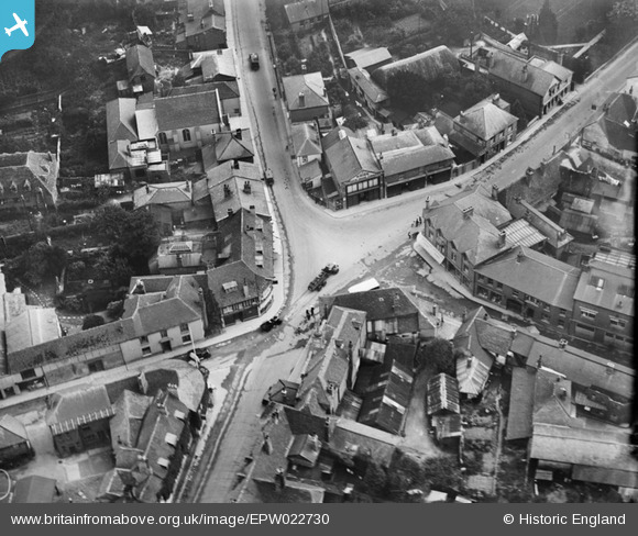
EPW022730 ENGLAND (1928). The town centre, Whitchurch, 1928
© Copyright OpenStreetMap contributors and licensed by the OpenStreetMap Foundation. 2026. Cartography is licensed as CC BY-SA.
Nearby Images (6)
EPW022730

EPW022729

EPW022731

EPW033346

EPW022732

EPW033348

Details
| Title | [EPW022730] The town centre, Whitchurch, 1928 |
| Reference | EPW022730 |
| Date | August-1928 |
| Link | |
| Place name | WHITCHURCH |
| Parish | WHITCHURCH |
| District | |
| Country | ENGLAND |
| Easting / Northing | 446251, 148064 |
| Longitude / Latitude | -1.3375303270687, 51.229373368251 |
| National Grid Reference | SU463481 |
Pins
Be the first to add a comment to this image!