
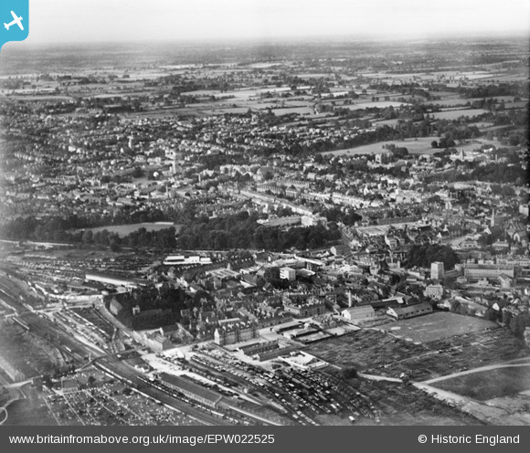
EPW022525 ENGLAND (1928). Worcester College and the city, Oxford, from the south-west, 1928
© Copyright OpenStreetMap contributors and licensed by the OpenStreetMap Foundation. 2026. Cartography is licensed as CC BY-SA.
Nearby Images (4)
EPW022525

EPW047767

EAW045711

EAW003603

Details
| Title | [EPW022525] Worcester College and the city, Oxford, from the south-west, 1928 |
| Reference | EPW022525 |
| Date | 11-August-1928 |
| Link | |
| Place name | OXFORD |
| Parish | |
| District | |
| Country | ENGLAND |
| Easting / Northing | 450743, 206079 |
| Longitude / Latitude | -1.264852514067, 51.750650253876 |
| National Grid Reference | SP507061 |
Pins

Seattle Man |
Monday 6th of May 2019 09:07:09 AM | |
|
Andy from Abingdon on Thames |
Saturday 21st of December 2013 11:54:10 PM | |
|
Andy from Abingdon on Thames |
Saturday 21st of December 2013 11:49:57 PM | |
|
Andy from Abingdon on Thames |
Saturday 21st of December 2013 11:45:34 PM |