
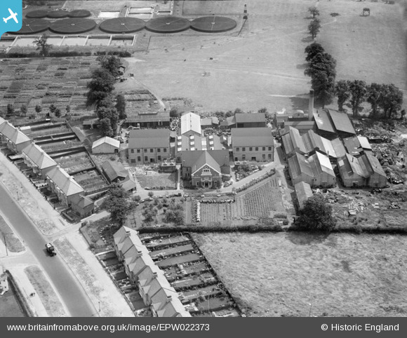
EPW022373 ENGLAND (1928). Johnsons of Hendon Chemical Factory and the Hendon Corporation Sewage Farm, Hendon, 1928
© Copyright OpenStreetMap contributors and licensed by the OpenStreetMap Foundation. 2026. Cartography is licensed as CC BY-SA.
Nearby Images (48)
EPW022373

EPW049485

EPW022370

EPW048979

EPW049483

EAW023661

EAW023662

EPW022830

EPW049487

EPW049221

EPW050373

EPW049220

EPW022371

EPW048980

EAW023660

EAW023657

EPW048981

EPW048982

EPW022374

EPW022646

EPW049218

EPW049484

EPW049486

EPW022369

EPW048977

EPW048978

EPW050377

EPW022507

EPW022645

EPW050376

EPW022506

EPW050375

EPW022505

EPW022508

EPW022831

EPW049219

EAW023655

EPW022504

EPW022372

EPW049488

EAW023656

EAW023658

EAW023659

EPW050374

EPW050378

EPW022647

EPW031658

EPW010014

Details
| Title | [EPW022373] Johnsons of Hendon Chemical Factory and the Hendon Corporation Sewage Farm, Hendon, 1928 |
| Reference | EPW022373 |
| Date | August-1928 |
| Link | |
| Place name | HENDON |
| Parish | |
| District | |
| Country | ENGLAND |
| Easting / Northing | 523147, 188087 |
| Longitude / Latitude | -0.22261431127485, 51.577702063435 |
| National Grid Reference | TQ231881 |
Pins
Be the first to add a comment to this image!