
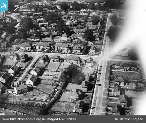
EPW022030 ENGLAND (1928). Russellcroft Road and Guessens Road, Welwyn Garden City, 1928
© Copyright OpenStreetMap contributors and licensed by the OpenStreetMap Foundation. 2026. Cartography is licensed as CC BY-SA.
Nearby Images (24)
EPW022030

EPW047356

EPW047357

EPW047379

EPW054540

EPW022018

EAW013992

EPW013424

EPW047367

EPW047366

EPW054542

EPW047369

EPW054540A

EPW047368

EPW022027

EAW035461

EPW025528

EPW025536

EPW022026

EPW047362

EPW047365

EPW062050

EPW022024

EPW047376

Details
| Title | [EPW022030] Russellcroft Road and Guessens Road, Welwyn Garden City, 1928 |
| Reference | EPW022030 |
| Date | July-1928 |
| Link | |
| Place name | WELWYN GARDEN CITY |
| Parish | |
| District | |
| Country | ENGLAND |
| Easting / Northing | 523446, 213030 |
| Longitude / Latitude | -0.20947512452521, 51.801820406938 |
| National Grid Reference | TL234130 |
Pins
Be the first to add a comment to this image!