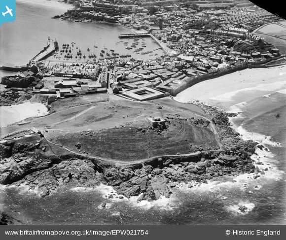
EPW021754 ENGLAND (1928). St Ives Head, the harbour and town, St Ives, from the north, 1928
© Copyright OpenStreetMap contributors and licensed by the OpenStreetMap Foundation. 2025. Cartography is licensed as CC BY-SA.
Nearby Images (2)
EPW021754

EAW004888

Details
| Title | [EPW021754] St Ives Head, the harbour and town, St Ives, from the north, 1928 |
| Reference | EPW021754 |
| Date | 24-June-1928 |
| Link | |
| Place name | ST IVES |
| Parish | ST. IVES |
| District | |
| Country | ENGLAND |
| Easting / Northing | 151966, 41178 |
| Longitude / Latitude | -5.4773768509338, 50.217896509693 |
| National Grid Reference | SW520412 |