
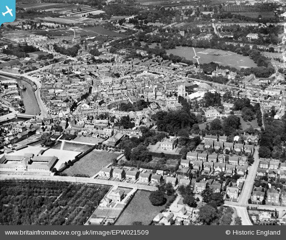
EPW021509 ENGLAND (1928). The town centre, Wisbech, from the south-west, 1928
© Copyright OpenStreetMap contributors and licensed by the OpenStreetMap Foundation. 2026. Cartography is licensed as CC BY-SA.
Nearby Images (3)
EPW021509

EPW039188

EPW021504

Details
| Title | [EPW021509] The town centre, Wisbech, from the south-west, 1928 |
| Reference | EPW021509 |
| Date | June-1928 |
| Link | |
| Place name | WISBECH |
| Parish | WISBECH |
| District | |
| Country | ENGLAND |
| Easting / Northing | 546042, 309361 |
| Longitude / Latitude | 0.15966013435218, 52.661920970228 |
| National Grid Reference | TF460094 |
Pins

Peter |
Saturday 31st of January 2015 08:51:53 PM | |
|
Peter |
Saturday 31st of January 2015 08:50:48 PM | |
|
Viscount |
Friday 20th of December 2013 06:52:17 PM | |
|
Viscount |
Friday 20th of December 2013 06:49:54 PM | |
|
Viscount |
Friday 20th of December 2013 06:48:21 PM | |
|
Viscount |
Friday 20th of December 2013 06:46:37 PM | |
|
Viscount |
Friday 20th of December 2013 06:43:33 PM | |
|
Richard Humphrey |
Monday 25th of March 2013 08:00:45 AM | |
|
Peter |
Thursday 20th of December 2012 08:22:11 PM | |
|
Peter |
Wednesday 12th of December 2012 08:37:35 PM | |
|
Peter |
Monday 10th of December 2012 09:15:20 PM |