
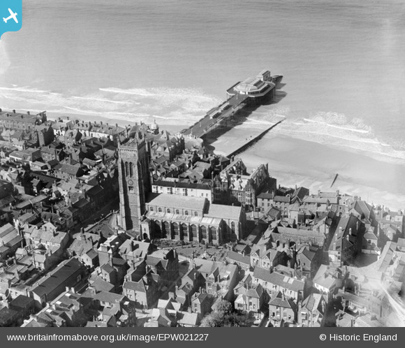
EPW021227 ENGLAND (1928). St Peter and St Paul's Church and the Pier, Cromer, 1928
© Copyright OpenStreetMap contributors and licensed by the OpenStreetMap Foundation. 2026. Cartography is licensed as CC BY-SA.
Nearby Images (16)
EPW021227

EPW001812

EAW051646

EAW051642

EPW039248

EPW001815

EAW051647

EAW051643

EPW039246

EPW021226

EPW021224

EAW051641

EPW001817

EPW001816

EPW001811

EAW051648

Details
| Title | [EPW021227] St Peter and St Paul's Church and the Pier, Cromer, 1928 |
| Reference | EPW021227 |
| Date | May-1928 |
| Link | |
| Place name | CROMER |
| Parish | CROMER |
| District | |
| Country | ENGLAND |
| Easting / Northing | 621959, 342277 |
| Longitude / Latitude | 1.3029747105272, 52.9316142589 |
| National Grid Reference | TG220423 |
Pins

John W |
Sunday 21st of June 2020 08:42:43 PM | |
|
Chris Booty |
Thursday 21st of February 2019 04:20:49 PM | |
 |

melgibbs |
Wednesday 5th of March 2014 08:46:10 PM |

Alan McFaden |
Friday 19th of July 2013 06:41:36 PM | |
|
Alan McFaden |
Friday 19th of July 2013 06:40:13 PM | |
|
Alan McFaden |
Friday 19th of July 2013 06:39:21 PM | |
|
Hugh Madgin |
Wednesday 22nd of May 2013 09:15:55 PM | |
|
Hugh Madgin |
Wednesday 22nd of May 2013 09:15:29 PM | |

Class31 |
Monday 3rd of September 2012 08:58:19 PM | |
|
Class31 |
Monday 3rd of September 2012 08:56:57 PM | |

macbrack |
Tuesday 26th of June 2012 12:05:53 PM |


