
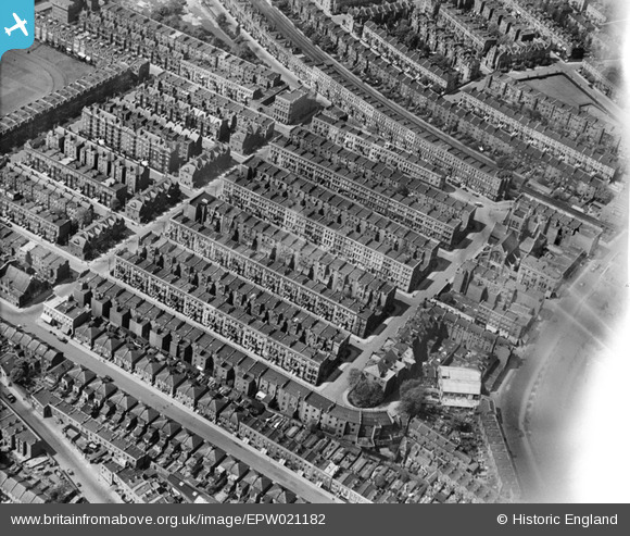
EPW021182 ENGLAND (1928). Charleville Road and environs, West Kensington, 1928
© Copyright OpenStreetMap contributors and licensed by the OpenStreetMap Foundation. 2026. Cartography is licensed as CC BY-SA.
Nearby Images (2)
EPW021182

EPW024247

Details
| Title | [EPW021182] Charleville Road and environs, West Kensington, 1928 |
| Reference | EPW021182 |
| Date | April-1928 |
| Link | |
| Place name | WEST KENSINGTON |
| Parish | |
| District | |
| Country | ENGLAND |
| Easting / Northing | 524544, 178161 |
| Longitude / Latitude | -0.20597345941954, 51.488179828386 |
| National Grid Reference | TQ245782 |
Pins

Des Elmes |
Wednesday 14th of December 2022 04:00:48 AM | |
|
Des Elmes |
Wednesday 14th of December 2022 03:58:38 AM | |
|
Des Elmes |
Wednesday 14th of December 2022 03:43:15 AM | |

Leslie B |
Wednesday 5th of October 2022 05:34:24 PM | |
|
ian |
Wednesday 12th of November 2014 06:22:01 PM | |

Class31 |
Monday 29th of September 2014 03:42:38 PM | |
|
Class31 |
Monday 29th of September 2014 03:41:59 PM | |
|
Class31 |
Monday 29th of September 2014 03:41:11 PM | |
|
Class31 |
Monday 29th of September 2014 03:40:11 PM | |
|
Class31 |
Monday 29th of September 2014 03:39:12 PM |


