
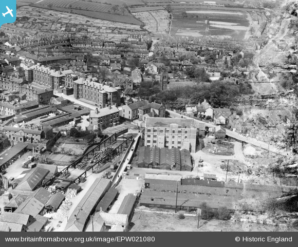
EPW021080 ENGLAND (1928). Union Walk and Holy Trinity Church, Chesterfield, 1928
© Copyright OpenStreetMap contributors and licensed by the OpenStreetMap Foundation. 2026. Cartography is licensed as CC BY-SA.
Nearby Images (2)
EPW021080

EAW042512

Details
| Title | [EPW021080] Union Walk and Holy Trinity Church, Chesterfield, 1928 |
| Reference | EPW021080 |
| Date | April-1928 |
| Link | |
| Place name | CHESTERFIELD |
| Parish | |
| District | |
| Country | ENGLAND |
| Easting / Northing | 438203, 371531 |
| Longitude / Latitude | -1.4275178881628, 53.239150746652 |
| National Grid Reference | SK382715 |
Pins

Pete L |
Friday 21st of April 2017 10:14:35 PM |