
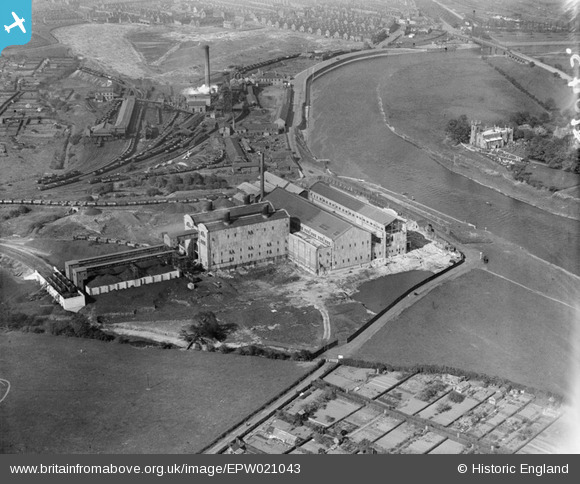
EPW021043 ENGLAND (1928). Wilford Power Station, Clifton Colliery and St Wilfrid's Church, Nottingham, 1928
© Copyright OpenStreetMap contributors and licensed by the OpenStreetMap Foundation. 2026. Cartography is licensed as CC BY-SA.
Nearby Images (43)
EPW021043

EAW018462

EAW018458

EAW009122

EAW033481

EAW018459

EAW033478

EAW033480

EAW033487

EAW033482

EAW033483

EAW033484

EAW046569

EAW033477

EAW018453

EAW046570

EAW046571

EAW046572

EAW018455

EAW033486

EAW018457

EAW018461

EAW009118

EAW009123

EAW046576

EAW046575

EAW046574

EAW018460

EAW009119

EAW009116

EAW009120

EAW018454

EAW033485

EAW009117

EAW009127

EAW009125

EAW018456

EAW009126

EAW009124

EAW018452

EAW009121

EAW046573

EAW018451

Details
| Title | [EPW021043] Wilford Power Station, Clifton Colliery and St Wilfrid's Church, Nottingham, 1928 |
| Reference | EPW021043 |
| Date | April-1928 |
| Link | |
| Place name | NOTTINGHAM |
| Parish | |
| District | |
| Country | ENGLAND |
| Easting / Northing | 456360, 337657 |
| Longitude / Latitude | -1.1613972806813, 52.933036350841 |
| National Grid Reference | SK564377 |
Pins

User Comment Contributions
Two kinds of power opposed to each other over the water. Not well enough composed or with good enough light to be a real contender. Odd though. |

Oliver Brookes |
Thursday 21st of March 2013 03:05:20 PM |