
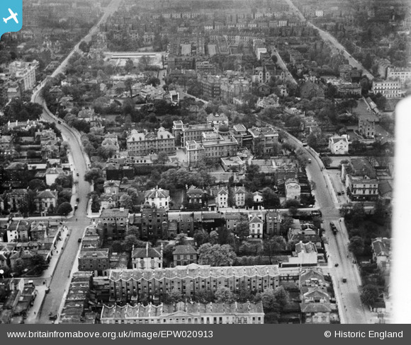
EPW020913 ENGLAND (1928). The Hospital of St John and St Elizabeth and environs, St John's Wood, 1928
© Copyright OpenStreetMap contributors and licensed by the OpenStreetMap Foundation. 2026. Cartography is licensed as CC BY-SA.
Nearby Images (13)
EPW020913

EPW020911

EPW020917

EPW020912

EPW020698

EPW020914

EPW020915

EPW020916

EPW020697

EPW020699

EAW044241

EAW018356

EPW045411

Details
| Title | [EPW020913] The Hospital of St John and St Elizabeth and environs, St John's Wood, 1928 |
| Reference | EPW020913 |
| Date | April-1928 |
| Link | |
| Place name | ST JOHN'S WOOD |
| Parish | |
| District | |
| Country | ENGLAND |
| Easting / Northing | 526702, 183187 |
| Longitude / Latitude | -0.17309831972596, 51.532873621697 |
| National Grid Reference | TQ267832 |
Pins

Bob |
Wednesday 5th of March 2025 04:17:16 PM | |
|
Bob |
Wednesday 5th of March 2025 04:16:47 PM | |
|
Kathy Emery |
Monday 29th of April 2024 04:48:56 PM |