
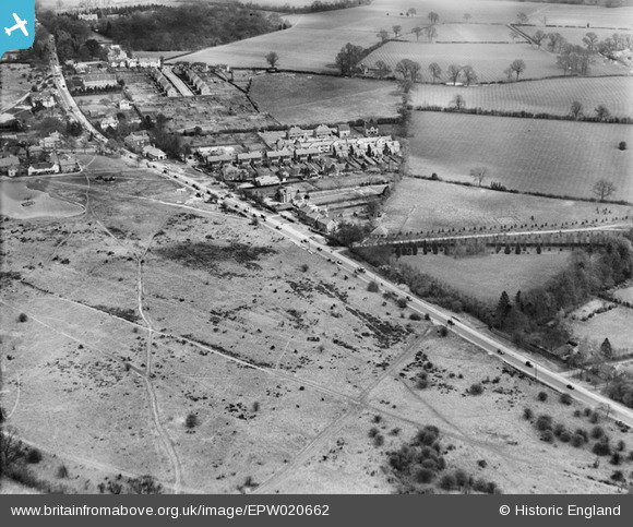
EPW020662 ENGLAND (1928). The Brighton Road (A217), Burgh Heath, 1928
© Copyright OpenStreetMap contributors and licensed by the OpenStreetMap Foundation. 2026. Cartography is licensed as CC BY-SA.
Nearby Images (2)
EPW020662
, Burgh Heath, 1928")
EPW020664
, Burgh Heath, 1928")
Details
| Title | [EPW020662] The Brighton Road (A217), Burgh Heath, 1928 |
| Reference | EPW020662 |
| Date | March-1928 |
| Link | |
| Place name | BURGH HEATH |
| Parish | |
| District | |
| Country | ENGLAND |
| Easting / Northing | 524170, 157522 |
| Longitude / Latitude | -0.2185801623486, 51.302752580471 |
| National Grid Reference | TQ242575 |
Pins

christhewino |
Friday 28th of December 2012 12:07:20 PM | |
|
christhewino |
Friday 28th of December 2012 12:06:24 PM |