
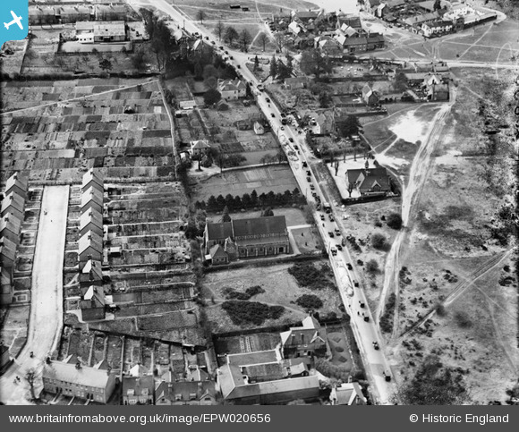
EPW020656 ENGLAND (1928). St Mary's Church and Brighton Road (A217), Burgh Heath, 1928
© Copyright OpenStreetMap contributors and licensed by the OpenStreetMap Foundation. 2026. Cartography is licensed as CC BY-SA.
Nearby Images (3)
EPW020656
, Burgh Heath, 1928")
EPW020657
, Burgh Heath, 1928")
EPW020661
, Burgh Heath, 1928")
Details
| Title | [EPW020656] St Mary's Church and Brighton Road (A217), Burgh Heath, 1928 |
| Reference | EPW020656 |
| Date | March-1928 |
| Link | |
| Place name | BURGH HEATH |
| Parish | |
| District | |
| Country | ENGLAND |
| Easting / Northing | 524300, 157951 |
| Longitude / Latitude | -0.21656657875233, 51.306580245756 |
| National Grid Reference | TQ243580 |
Pins

christhewino |
Tuesday 10th of January 2023 09:44:32 PM | |
|
Banstead100 |
Friday 22nd of April 2016 09:29:31 PM | |
|
Banstead100 |
Friday 22nd of April 2016 09:27:42 PM | |
|
Banstead100 |
Friday 22nd of April 2016 09:26:46 PM | |
|
Banstead100 |
Friday 22nd of April 2016 09:26:27 PM | |
|
Banstead100 |
Friday 22nd of April 2016 09:26:02 PM | |
|
David960 |
Saturday 24th of January 2015 11:46:57 AM |