
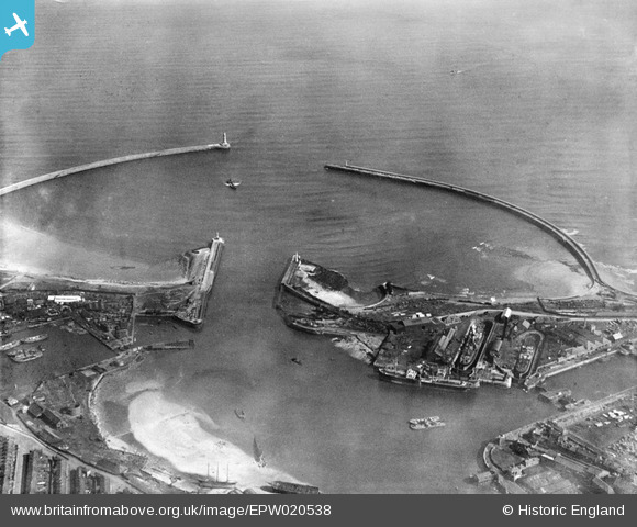
EPW020538 ENGLAND (1928). The harbour entrance, Sunderland, 1928
© Copyright OpenStreetMap contributors and licensed by the OpenStreetMap Foundation. 2026. Cartography is licensed as CC BY-SA.
Nearby Images (4)
EPW020538

EPW020534

EAW001020

EAW001019

Details
| Title | [EPW020538] The harbour entrance, Sunderland, 1928 |
| Reference | EPW020538 |
| Date | March-1928 |
| Link | |
| Place name | SUNDERLAND |
| Parish | |
| District | |
| Country | ENGLAND |
| Easting / Northing | 441166, 558260 |
| Longitude / Latitude | -1.3577190662937, 54.917259211631 |
| National Grid Reference | NZ412583 |
Pins

Steve A |
Friday 23rd of August 2013 03:49:57 PM |