
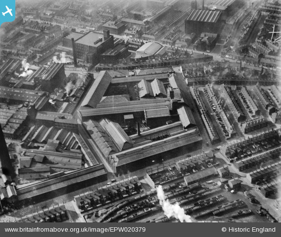
EPW020379 ENGLAND (1928). The Globe Iron Works, Bolton, 1928
© Copyright OpenStreetMap contributors and licensed by the OpenStreetMap Foundation. 2026. Cartography is licensed as CC BY-SA.
Nearby Images (9)
EPW020379

EPW020374

EPW020380

EPW020373

EPW020377

EPW020378

EPW020376

EPW020375

EPW057233

Details
| Title | [EPW020379] The Globe Iron Works, Bolton, 1928 |
| Reference | EPW020379 |
| Date | March-1928 |
| Link | |
| Place name | BOLTON |
| Parish | |
| District | |
| Country | ENGLAND |
| Easting / Northing | 371808, 410114 |
| Longitude / Latitude | -2.4259209743823, 53.586612701434 |
| National Grid Reference | SD718101 |
Pins

Carol AFGW |
Monday 25th of July 2016 02:46:38 PM | |

Class31 |
Wednesday 4th of May 2016 08:16:20 AM |
