
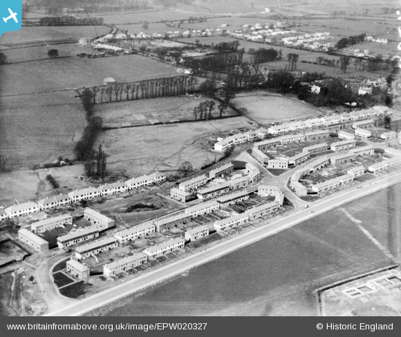
EPW020327 ENGLAND (1928). New housing at Stanhope Road, Greenford, 1928
© Copyright OpenStreetMap contributors and licensed by the OpenStreetMap Foundation. 2026. Cartography is licensed as CC BY-SA.
Nearby Images (13)
EPW020327

EPW020330

EPW020330
EPW056286

EPW020325

EPW020326

EPW056274

EPW056275

EPW020329

EPW020329
EPW020328

EPW020324

EPW056277

Details
| Title | [EPW020327] New housing at Stanhope Road, Greenford, 1928 |
| Reference | EPW020327 |
| Date | February-1928 |
| Link | |
| Place name | GREENFORD |
| Parish | |
| District | |
| Country | ENGLAND |
| Easting / Northing | 514192, 181980 |
| Longitude / Latitude | -0.35378549680006, 51.524693742812 |
| National Grid Reference | TQ142820 |
Pins

Des Elmes |
Tuesday 5th of April 2016 01:29:42 AM | |
|
Des Elmes |
Tuesday 5th of April 2016 01:28:52 AM | |
|
Des Elmes |
Tuesday 5th of April 2016 01:28:05 AM | |
|
Des Elmes |
Tuesday 5th of April 2016 01:26:49 AM | |
|
Des Elmes |
Tuesday 5th of April 2016 01:26:01 AM |