
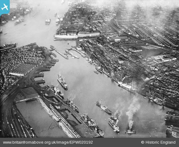
EPW020192 ENGLAND (1927). The Tyne Dock, South Shields, 1927
© Copyright OpenStreetMap contributors and licensed by the OpenStreetMap Foundation. 2026. Cartography is licensed as CC BY-SA.
Nearby Images (3)
EPW020192

EPW020192
EPW048811

Details
| Title | [EPW020192] The Tyne Dock, South Shields, 1927 |
| Reference | EPW020192 |
| Date | 16-December-1927 |
| Link | |
| Place name | SOUTH SHIELDS |
| Parish | |
| District | |
| Country | ENGLAND |
| Easting / Northing | 435322, 565566 |
| Longitude / Latitude | -1.4479942969783, 54.983364924441 |
| National Grid Reference | NZ353656 |
Pins

Smiler2000 |
Monday 1st of February 2021 03:51:37 AM |