
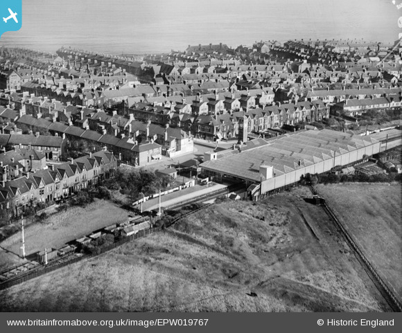
EPW019767 ENGLAND (1927). The station, Whitley Bay, 1927
© Copyright OpenStreetMap contributors and licensed by the OpenStreetMap Foundation. 2026. Cartography is licensed as CC BY-SA.
Nearby Images (2)
EPW019767

EPW019774

Details
| Title | [EPW019767] The station, Whitley Bay, 1927 |
| Reference | EPW019767 |
| Date | 18-October-1927 |
| Link | |
| Place name | WHITLEY BAY |
| Parish | |
| District | |
| Country | ENGLAND |
| Easting / Northing | 435686, 571883 |
| Longitude / Latitude | -1.4415177315127, 55.040108438501 |
| National Grid Reference | NZ357719 |
Pins

Chells809 |
Sunday 1st of September 2013 12:12:23 AM | |

Class31 |
Monday 21st of January 2013 04:57:31 PM | |
|
Class31 |
Monday 21st of January 2013 04:57:14 PM | |
|
Class31 |
Monday 21st of January 2013 04:55:03 PM | |
|
Class31 |
Monday 21st of January 2013 04:53:54 PM | |
|
Class31 |
Monday 21st of January 2013 04:52:29 PM | |
|
Class31 |
Monday 21st of January 2013 04:52:03 PM |
User Comment Contributions
Does anyone have any pictures or info on a shop possibly a sweet shop that used to be on egremont place? |
WHITLEY13 |
Sunday 24th of February 2013 11:19:10 PM |