
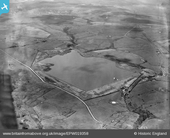
EPW019358 ENGLAND (1927). The Delph Reservoir, Belmont, 1927
© Copyright OpenStreetMap contributors and licensed by the OpenStreetMap Foundation. 2025. Cartography is licensed as CC BY-SA.
Nearby Images (4)
EPW019358

EPW019355

EPW019357

EAW002686A
, Turton Moor, 1946")
Details
| Title | [EPW019358] The Delph Reservoir, Belmont, 1927 |
| Reference | EPW019358 |
| Date | September-1927 |
| Link | |
| Place name | BELMONT |
| Parish | NORTH TURTON |
| District | |
| Country | ENGLAND |
| Easting / Northing | 369957, 415796 |
| Longitude / Latitude | -2.4544327890755, 53.637585449081 |
| National Grid Reference | SD700158 |
Pins

totoro |
Monday 2nd of January 2017 09:26:50 PM | |
|
totoro |
Monday 2nd of January 2017 09:26:12 PM | |
|
totoro |
Monday 2nd of January 2017 09:14:50 PM | |
|
totoro |
Monday 2nd of January 2017 09:14:28 PM | |
|
totoro |
Monday 2nd of January 2017 09:13:57 PM | |
|
totoro |
Monday 2nd of January 2017 09:12:50 PM | |
|
totoro |
Monday 2nd of January 2017 09:10:40 PM | |
|
totoro |
Monday 2nd of January 2017 09:10:23 PM | |
|
totoro |
Monday 2nd of January 2017 09:03:00 PM | |
|
totoro |
Monday 2nd of January 2017 09:02:14 PM | |
|
totoro |
Monday 2nd of January 2017 09:00:07 PM | |
|
totoro |
Monday 2nd of January 2017 08:59:35 PM | |
|
totoro |
Monday 2nd of January 2017 08:57:35 PM | |
|
totoro |
Monday 2nd of January 2017 08:56:45 PM | |
|
totoro |
Monday 2nd of January 2017 08:55:49 PM | |
|
totoro |
Monday 2nd of January 2017 08:55:28 PM |