
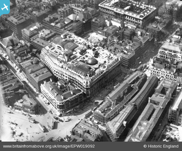
EPW019092 ENGLAND (1927). Lewis's Department Store and environs, Manchester, 1927. This image has been produced from a copy-negative.
© Copyright OpenStreetMap contributors and licensed by the OpenStreetMap Foundation. 2026. Cartography is licensed as CC BY-SA.
Nearby Images (19)
EPW019092

EPW019135

EPW019136

EAW050212

EAW015999

EAW038397

EPW038598

EPW041553

EPW055080

EAW038399

EAW050213

EPW038597

EPW038599

EPW045990

EPW038594

EPW060538

EPW055079

EPW038595

EPW038596

Details
| Title | [EPW019092] Lewis's Department Store and environs, Manchester, 1927. This image has been produced from a copy-negative. |
| Reference | EPW019092 |
| Date | 4-August-1927 |
| Link | |
| Place name | MANCHESTER |
| Parish | |
| District | |
| Country | ENGLAND |
| Easting / Northing | 384242, 398361 |
| Longitude / Latitude | -2.2374803705109, 53.481482286917 |
| National Grid Reference | SJ842984 |
