
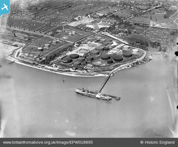
EPW018895 ENGLAND (1927). The Dingle Oil Terminal, Dingle, 1927
© Copyright OpenStreetMap contributors and licensed by the OpenStreetMap Foundation. 2026. Cartography is licensed as CC BY-SA.
Nearby Images (7)
EPW018895

EPW018896

EPW018894

EPW053302

EPW053299

EPW053298

EPW053297

Details
| Title | [EPW018895] The Dingle Oil Terminal, Dingle, 1927 |
| Reference | EPW018895 |
| Date | 17-July-1927 |
| Link | |
| Place name | DINGLE |
| Parish | |
| District | |
| Country | ENGLAND |
| Easting / Northing | 336018, 386818 |
| Longitude / Latitude | -2.9618231370042, 53.374077000835 |
| National Grid Reference | SJ360868 |
