
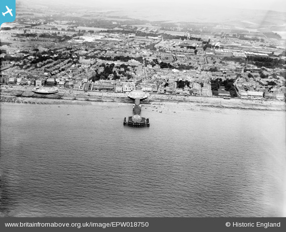
EPW018750 ENGLAND (1927). The pier, bandstand and town, Worthing, from the south-east, 1927
© Copyright OpenStreetMap contributors and licensed by the OpenStreetMap Foundation. 2026. Cartography is licensed as CC BY-SA.
Nearby Images (18)
EPW018750

EPW017740

EPW039495

EPW042998

EAW053163

EPW042995

EPW017738

EPW011535

EAW022242

EAW022244

EAW022745

EPW011524

EPW018751

EPW000753

EPW000749

EAW022243

EAW022245
 and the town, Worthing, from the south, 1949")
EPW018752

Details
| Title | [EPW018750] The pier, bandstand and town, Worthing, from the south-east, 1927 |
| Reference | EPW018750 |
| Date | July-1927 |
| Link | |
| Place name | WORTHING |
| Parish | |
| District | |
| Country | ENGLAND |
| Easting / Northing | 515073, 102028 |
| Longitude / Latitude | -0.36668024757266, 50.805801752116 |
| National Grid Reference | TQ151020 |
Pins

Alan McFaden |
Wednesday 1st of January 2014 11:24:41 PM | |
|
Alan McFaden |
Wednesday 1st of January 2014 11:24:15 PM | |
|
Alan McFaden |
Wednesday 1st of January 2014 11:23:49 PM | |
|
Alan McFaden |
Wednesday 1st of January 2014 03:41:35 PM | |
|
Alan McFaden |
Wednesday 4th of December 2013 06:04:17 PM | |
|
Alan McFaden |
Wednesday 13th of November 2013 03:16:25 PM |


