
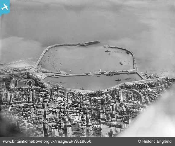
EPW018650 ENGLAND (1927). The Royal Harbour and basin, Ramsgate, 1927
© Copyright OpenStreetMap contributors and licensed by the OpenStreetMap Foundation. 2026. Cartography is licensed as CC BY-SA.
Nearby Images (29)
EPW018650

EAW009006

EAW009007

EAW017592

EAW009009

EPW018653

EPW000091

EAW009008

EPW039354

EPW000598

EAW015835

EAW015836

EAW009010

EPW035449

EAW020487

EAW006165

EPW000092

EAW006164

EPW000604

EPW000096

EAW017589

EAW008999

EPW042864

EPW000596

EAW020488

EPW039324

EAW009051

EAW696658

EAW024843

Details
| Title | [EPW018650] The Royal Harbour and basin, Ramsgate, 1927 |
| Reference | EPW018650 |
| Date | 22-June-1927 |
| Link | |
| Place name | RAMSGATE |
| Parish | RAMSGATE |
| District | |
| Country | ENGLAND |
| Easting / Northing | 638383, 164580 |
| Longitude / Latitude | 1.4223243239524, 51.329760532671 |
| National Grid Reference | TR384646 |
Pins

Alan McFaden |
Sunday 13th of July 2014 11:56:44 AM | |
|
Alan McFaden |
Sunday 13th of July 2014 11:56:00 AM | |
|
Alan McFaden |
Sunday 13th of July 2014 11:55:15 AM | |
|
Alan McFaden |
Sunday 13th of July 2014 11:54:13 AM |


