
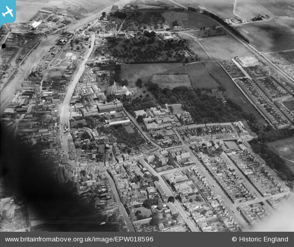
EPW018596 ENGLAND (1927). St Mary's Church and the site of St Saviour's Abbey and environs, Faversham, 1927
© Copyright OpenStreetMap contributors and licensed by the OpenStreetMap Foundation. 2026. Cartography is licensed as CC BY-SA.
Nearby Images (7)
EPW018596

EAW028819

EPW013292

EPW013293

EPW013291

EPW018591

EAW028820

Details
| Title | [EPW018596] St Mary's Church and the site of St Saviour's Abbey and environs, Faversham, 1927 |
| Reference | EPW018596 |
| Date | 22-June-1927 |
| Link | |
| Place name | FAVERSHAM |
| Parish | FAVERSHAM |
| District | |
| Country | ENGLAND |
| Easting / Northing | 601801, 161425 |
| Longitude / Latitude | 0.89613746168987, 51.315585304615 |
| National Grid Reference | TR018614 |
Pins

Dylan Moore |
Monday 17th of November 2014 11:30:24 AM |