
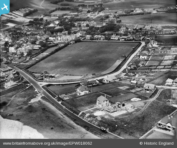
EPW018062 ENGLAND (1927). St Aubyns School playing field and environs, Rottingdean, 1927
© Copyright OpenStreetMap contributors and licensed by the OpenStreetMap Foundation. 2026. Cartography is licensed as CC BY-SA.
Nearby Images (26)
EPW018062

EPW017727

EPW017728

EPW042967

EPW017730

EPW017269

EPW018063

EPW017264

EPW017268

EPW017265

EPW017263

EPW018054

EPW017266

EPW017732

EPW042966

EPW017734

EPW017731

EPW017270

EPW054058

EPW017267

EPW018059

EPW017726

EPW035301

EAW024795

EPW018057

EPW018056

Details
| Title | [EPW018062] St Aubyns School playing field and environs, Rottingdean, 1927 |
| Reference | EPW018062 |
| Date | May-1927 |
| Link | |
| Place name | ROTTINGDEAN |
| Parish | ROTTINGDEAN |
| District | |
| Country | ENGLAND |
| Easting / Northing | 537166, 102244 |
| Longitude / Latitude | -0.053194276366411, 50.802933238803 |
| National Grid Reference | TQ372022 |
Pins
Be the first to add a comment to this image!