
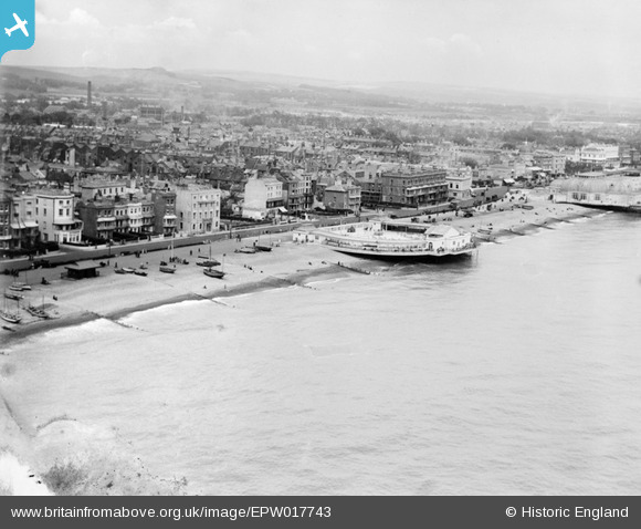
EPW017743 ENGLAND (1927). The bandstand and seafront, Worthing, from the south, 1927
© Copyright OpenStreetMap contributors and licensed by the OpenStreetMap Foundation. 2026. Cartography is licensed as CC BY-SA.
Nearby Images (17)
EPW017743

EPW042999

EAW053165

EPW000761

EPW045567

EAW053164

EPW039493

EAW022748

EAW022245
 and the town, Worthing, from the south, 1949")
EPW039496

EPW018752

EPW000725

EPW011532

EPW000749

EPW017741

EPW054071

EPW000719

Details
| Title | [EPW017743] The bandstand and seafront, Worthing, from the south, 1927 |
| Reference | EPW017743 |
| Date | April-1927 |
| Link | |
| Place name | WORTHING |
| Parish | |
| District | |
| Country | ENGLAND |
| Easting / Northing | 514703, 102231 |
| Longitude / Latitude | -0.37186622915504, 50.807700099285 |
| National Grid Reference | TQ147022 |
Pins

Alan McFaden |
Wednesday 1st of January 2014 10:56:57 PM | |
|
Alan McFaden |
Wednesday 1st of January 2014 03:44:59 PM | |
|
Alan McFaden |
Wednesday 1st of January 2014 03:44:32 PM | |
|
Alan McFaden |
Wednesday 1st of January 2014 03:44:05 PM | |
|
Alan McFaden |
Wednesday 4th of December 2013 06:18:55 PM |


