
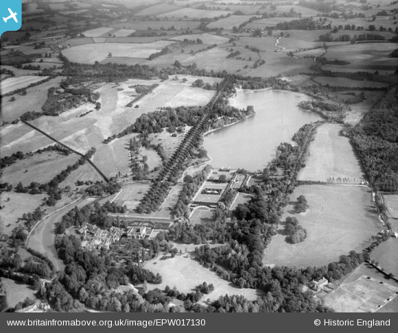
EPW017130 ENGLAND (1926). Hever Castle and grounds, Hever, 1926
© Copyright OpenStreetMap contributors and licensed by the OpenStreetMap Foundation. 2026. Cartography is licensed as CC BY-SA.
Nearby Images (4)
EPW017130

EAW005173

EAW005180

EAW005179

Details
| Title | [EPW017130] Hever Castle and grounds, Hever, 1926 |
| Reference | EPW017130 |
| Date | October-1926 |
| Link | |
| Place name | HEVER |
| Parish | HEVER |
| District | |
| Country | ENGLAND |
| Easting / Northing | 548202, 145311 |
| Longitude / Latitude | 0.12090879357142, 51.187265688957 |
| National Grid Reference | TQ482453 |
Pins
Be the first to add a comment to this image!
User Comment Contributions
Hever Castle |

Robert - Cumbria |
Wednesday 27th of June 2012 04:32:05 PM |
Great shot of the landscape, including the Castle, lake and avenue of trees. |
royalfixit |
Wednesday 27th of June 2012 06:35:46 AM |