
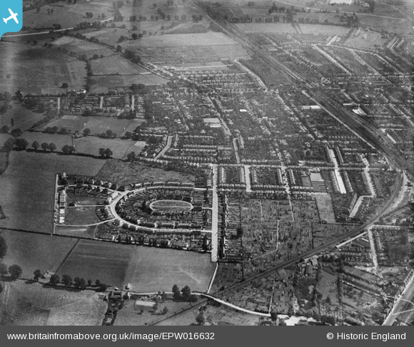
EPW016632 ENGLAND (1926). The Crescent and Mount Pleasant Road, New Malden, 1926
© Copyright OpenStreetMap contributors and licensed by the OpenStreetMap Foundation. 2026. Cartography is licensed as CC BY-SA.
Nearby Images (4)
EPW016632

EPW017153

EPW016628

EPW017158

Details
| Title | [EPW016632] The Crescent and Mount Pleasant Road, New Malden, 1926 |
| Reference | EPW016632 |
| Date | August-1926 |
| Link | |
| Place name | NEW MALDEN |
| Parish | |
| District | |
| Country | ENGLAND |
| Easting / Northing | 520749, 168911 |
| Longitude / Latitude | -0.26376908878973, 51.405859957604 |
| National Grid Reference | TQ207689 |
