
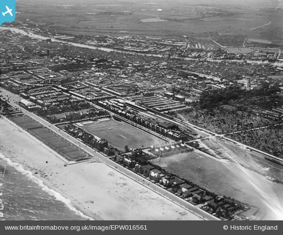
EPW016561 ENGLAND (1926). The Wellesley Recreation Ground and Beach Station and environs, Great Yarmouth, from the north-east, 1926
© Copyright OpenStreetMap contributors and licensed by the OpenStreetMap Foundation. 2026. Cartography is licensed as CC BY-SA.
Nearby Images (3)
EPW016561

EPW001874

EPW021190

Details
| Title | [EPW016561] The Wellesley Recreation Ground and Beach Station and environs, Great Yarmouth, from the north-east, 1926 |
| Reference | EPW016561 |
| Date | 26-August-1926 |
| Link | |
| Place name | GREAT YARMOUTH |
| Parish | |
| District | |
| Country | ENGLAND |
| Easting / Northing | 653036, 308317 |
| Longitude / Latitude | 1.7381894600422, 52.613209752847 |
| National Grid Reference | TG530083 |
Pins

christhewino |
Wednesday 15th of March 2023 06:54:21 PM | |
|
Bill_Gensheet |
Sunday 24th of June 2018 03:21:22 PM | |
|
gerrywho |
Thursday 11th of January 2018 01:31:33 PM | |
|
gerrywho |
Thursday 11th of January 2018 01:27:35 PM | |
|
gerrywho |
Thursday 11th of January 2018 01:24:20 PM | |
|
gerrywho |
Thursday 11th of January 2018 01:22:04 PM | |
|
gerrywho |
Thursday 11th of January 2018 01:20:02 PM | |

Class31 |
Wednesday 5th of September 2012 10:04:56 PM | |
Opened 1877, closed 1959, now demolished. See http://www.disused-stations.org.uk/y/yarmouth_beach/index.shtml for more information and photos of the station before and after closure. |
John W |
Friday 5th of August 2016 05:54:09 PM |