
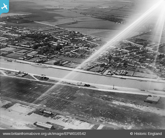
EPW016542 ENGLAND (1926). The town and River Yare, Gorleston-on-Sea, 1926
© Copyright OpenStreetMap contributors and licensed by the OpenStreetMap Foundation. 2026. Cartography is licensed as CC BY-SA.
Nearby Images (2)
EPW016542

EPW016542
Details
| Title | [EPW016542] The town and River Yare, Gorleston-on-Sea, 1926 |
| Reference | EPW016542 |
| Date | August-1926 |
| Link | |
| Place name | GORLESTON-ON-SEA |
| Parish | |
| District | |
| Country | ENGLAND |
| Easting / Northing | 652827, 304440 |
| Longitude / Latitude | 1.7321479020385, 52.578523652365 |
| National Grid Reference | TG528044 |
Pins

redmist |
Wednesday 19th of January 2022 01:22:24 PM | |
|
redmist |
Wednesday 19th of January 2022 01:21:35 PM | |
|
c.c |
Monday 26th of August 2013 01:24:57 PM | |
|
gorlestonguy |
Saturday 4th of May 2013 04:58:19 PM | |
|
gorlestonguy |
Saturday 4th of May 2013 04:53:24 PM | |
|
gorlestonguy |
Saturday 4th of May 2013 04:47:29 PM | |
|
c.c |
Sunday 14th of October 2012 11:06:09 AM |


