
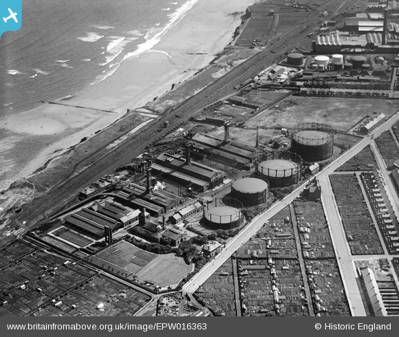
EPW016363 ENGLAND (1926). The Gas Works at Hendon, Sunderland, 1926
© Copyright OpenStreetMap contributors and licensed by the OpenStreetMap Foundation. 2026. Cartography is licensed as CC BY-SA.
Nearby Images (9)
EPW016363

EPW016364

EPW016368

EPW016365

EPW016367

EPW016370

EPW016362

EPW016369

EPW016366

Details
| Title | [EPW016363] The Gas Works at Hendon, Sunderland, 1926 |
| Reference | EPW016363 |
| Date | 29-July-1926 |
| Link | |
| Place name | SUNDERLAND |
| Parish | |
| District | |
| Country | ENGLAND |
| Easting / Northing | 440914, 555460 |
| Longitude / Latitude | -1.3620485274666, 54.892116876147 |
| National Grid Reference | NZ409555 |
