
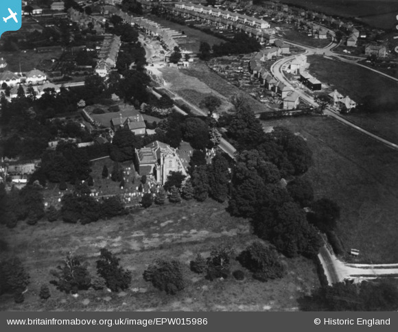
EPW015986 ENGLAND (1926). St Lawrence's Church and Whitchurch Lane, Canons Park, 1926. This image has been produced from a print.
© Copyright OpenStreetMap contributors and licensed by the OpenStreetMap Foundation. 2026. Cartography is licensed as CC BY-SA.
Nearby Images (2)
EPW015986

EPW021260

Details
| Title | [EPW015986] St Lawrence's Church and Whitchurch Lane, Canons Park, 1926. This image has been produced from a print. |
| Reference | EPW015986 |
| Date | 30-June-1926 |
| Link | |
| Place name | CANONS PARK |
| Parish | |
| District | |
| Country | ENGLAND |
| Easting / Northing | 518565, 191313 |
| Longitude / Latitude | -0.28762387073985, 51.607681090669 |
| National Grid Reference | TQ186913 |
Pins
Be the first to add a comment to this image!