
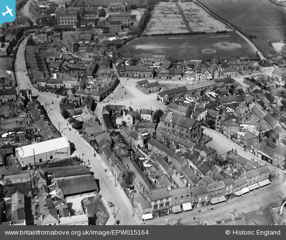
EPW015164 ENGLAND (1926). The Green, Ashby-de-la-Zouch, 1926
© Copyright OpenStreetMap contributors and licensed by the OpenStreetMap Foundation. 2026. Cartography is licensed as CC BY-SA.
Nearby Images (13)
EPW015164

EPW015158

EPW015163

EPW015159

EAW036571

EPW015157

EAW036569

EAW036572

EAW036565

EAW036566

EAW036568

EAW036573

EAW036570

Details
| Title | [EPW015164] The Green, Ashby-de-la-Zouch, 1926 |
| Reference | EPW015164 |
| Date | 13-May-1926 |
| Link | |
| Place name | ASHBY-DE-LA-ZOUCH |
| Parish | ASHBY-DE-LA-ZOUCH |
| District | |
| Country | ENGLAND |
| Easting / Northing | 435683, 316808 |
| Longitude / Latitude | -1.471321251885, 52.747375075956 |
| National Grid Reference | SK357168 |
Pins

Saskia |
Thursday 12th of March 2020 02:08:36 PM | |
|
Oliver Mills |
Thursday 26th of May 2016 11:10:20 AM | |
|
smed smith |
Thursday 6th of March 2014 07:16:35 AM |