
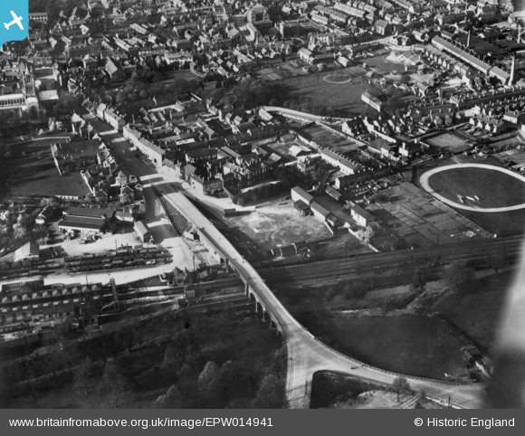
EPW014941 ENGLAND (1926). Burton End Bridge, Burton Street and Mill Street, Melton Mowbray, 1926. This image has been produced from a copy-negative.
© Copyright OpenStreetMap contributors and licensed by the OpenStreetMap Foundation. 2026. Cartography is licensed as CC BY-SA.
Nearby Images (7)
EPW014941

EAW049202

EPW058212

EAW049203

EPW014944

EPW058211

EPW014943

Details
| Title | [EPW014941] Burton End Bridge, Burton Street and Mill Street, Melton Mowbray, 1926. This image has been produced from a copy-negative. |
| Reference | EPW014941 |
| Date | 11-April-1926 |
| Link | |
| Place name | MELTON MOWBRAY |
| Parish | |
| District | |
| Country | ENGLAND |
| Easting / Northing | 475425, 318834 |
| Longitude / Latitude | -0.88212817611658, 52.76150133581 |
| National Grid Reference | SK754188 |
Pins
Be the first to add a comment to this image!